Portfolio
Modelling Canopy Height Model with LiDAR and Photogrammetric-derived Point Clouds

Using point cloud data to create a DTM and a DSM in order to calculate canopy height model.
Lake Explorer for Peterborough and the Kawarthas

Esri-based website and tools for understanding lake bathymetry and water quality indicators for lakes within Peterborough and the Kawarthas.
Chiniguchi Waterways Provincial Park Canoe Route Map

Canoe route map for navigating Chiniguchi Waterways Provincial Park in northern Ontario.
Enhanced Flow Direction Grid

Enhanced Flow Direction Grid for Ganaraska Forest. Comparison of drainage lines from ANUDEM interpolated DEM to photogrammetric representation.
Kootenay Valley Remote Sensing Image Analysis

Three different methods of image analysis using Catalyst (PCI Geomatica): Pansharpened True Colour Composite, SWIR, Standard False Colour Composite.
Ranked Habitat Analysis for Salamanders
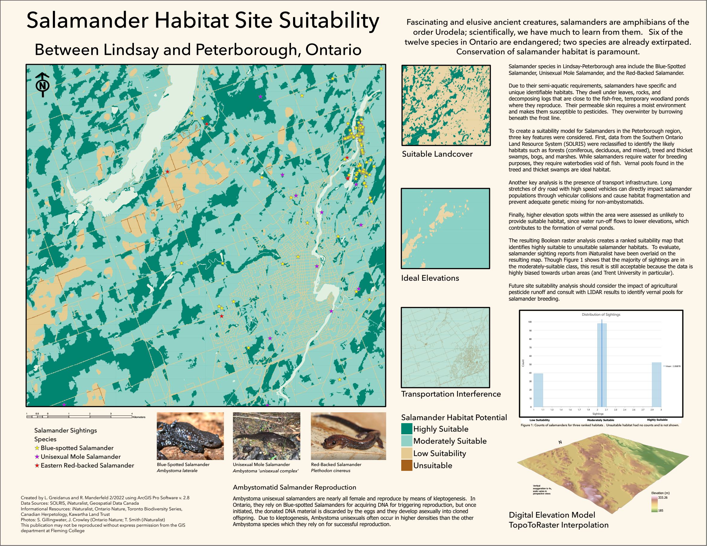
Site suitability analysis using DEM, salamander sightings, and ideal habitat data.
Supervised Classification of Oak Ridges Morraine

Supervised classification of orthophotography using PCI Geomatica / Catalyst of the Oak Ridges Morraine area.